Search data © OpenStreetMap ·
Data licences

OpenStreetMap data is available under the Open Database Licence.

Postcode data contains Ordnance Survey data © Crown copyright and database right 2025; Royal Mail data © Royal Mail copyright and database right 2025; National Statistics data © Crown copyright and database right 2025; NRS data © Crown copyright and database right 2025. Postcode data licences.

Destination boundaries: Office for National Statistics and © Natural England; contains Ordnance Survey data © Crown copyright and database right. Open Government Licence v3. Paphos municipality: © OpenStreetMap contributors, Open Database Licence.

92 places in Cornwall Road Alerts
Explore destinationsUnited Kingdom

Showing 30 of 92 places

Resort
Google · Photo: Retallack Resort
Creator: Retallack Resort Source: Google Maps Retallack Resort

Retallack Resort

St Columb Major

A lakeside North Cornwall resort with FlowRider surfing, seasonal watersports, an indoor pool, spa and places to eat. Check the operator’s calendar for day-visitor sessions and access.

Coverage not confirmed
Trethevy Quoit
Historic site
Photo: JimChampion
Creator: JimChampion Source: Wikimedia Commons JimChampion · CC BY-SA 3.0 · Wikimedia Commons Source CC BY-SA 3.0 Licence

Trethevy Quoit

St Cleer

Trethevy Quoit is a striking Neolithic burial chamber near St Cleer. Five upright stones support a vast capstone, forming a dolmen about 2.7 metres high whose monumental structure remains easy to read.

Coverage not confirmed
St Breock Downs Monolith
Historic site
Photo: Richard-sr
Creator: Richard-sr Source: Wikimedia Commons Richard-sr · CC BY-SA 3.0 · Wikimedia Commons Source CC BY-SA 3.0 Licence

St Breock Downs Monolith

Rosenannon

St Breock Downs Monolith is Cornwall’s largest known prehistoric standing stone, originally about five metres high and weighing roughly 16.75 tonnes. Its summit setting opens broad views across the surrounding downs.

Coverage not confirmed
Penhallam
Historic site
Photo: Ruth Swetnam
Creator: Ruth Swetnam Source: Wikimedia Commons Ruth Swetnam · CC BY-SA 2.0 · Wikimedia Commons Source CC BY-SA 2.0 Licence

Penhallam

Holsworthy

Penhallam reveals the grass-covered ground plan of a moated medieval manor in a secluded Cornish woodland. Low foundations outline the rooms and courtyard of the 13th-century house.

Coverage not confirmed
King Doniert's Stone
Historic site
Photo: TinWidget at English Wikipedia
Creator: TinWidget at English Wikipedia Source: Wikimedia Commons TinWidget at English Wikipedia · CC BY 3.0 · Wikimedia Commons Source CC BY 3.0 Licence

King Doniert's Stone

Liskeard

King Doniert’s Stone comprises two richly carved fragments of a 9th-century cross near St Cleer. One carries an inscription commemorating Dumgarth, a king of Dumnonia who died around AD 875.

Coverage not confirmed
Hurlers Stone Circles
Historic site
Photo: Olaf Tausch
Creator: Olaf Tausch Source: Wikimedia Commons Olaf Tausch · CC BY 3.0 · Wikimedia Commons Source CC BY 3.0 Licence

Hurlers Stone Circles

Liskeard

The Hurlers comprise three aligned prehistoric circles on Bodmin Moor, raised around the transition from the Neolithic to the Bronze Age. This rare arrangement can be explored in an open upland landscape near Minions.

Coverage not confirmed
Halliggye Fogou
Historic site
Photo: Jim Champion
Creator: Jim Champion Source: Wikimedia Commons Jim Champion · CC BY-SA 3.0 · Wikimedia Commons Source CC BY-SA 3.0 Licence

Halliggye Fogou

Helston

Halliggye Fogou is Cornwall’s largest and best-preserved underground passage complex associated with an Iron Age settlement. Stone-lined walls and surviving roof slabs create an unusually tangible encounter with this enigmatic building type.

Coverage not confirmed
Dupath Well
Historic site
Photo: Michael Garlick
Creator: Michael Garlick Source: Wikimedia Commons Michael Garlick · CC BY-SA 2.0 · Wikimedia Commons Source CC BY-SA 2.0 Licence

Dupath Well

Callington

Dupath Well is a complete early-16th-century well house built over an ancient spring near Callington. Its carefully worked granite architecture shelters waters once credited in local tradition with healing whooping cough.

Coverage not confirmed
Carn Euny Ancient Village
Historic site
Photo: Andy Wright
Creator: Andy Wright Source: Wikimedia Commons Andy Wright · CC BY 2.0 · Wikimedia Commons Source CC BY 2.0 Licence

Carn Euny Ancient Village

Penzance

Carn Euny preserves the stone foundations of a settlement occupied from the Iron Age into Roman times. Visitors can trace its houses and enter the distinctive underground fogou, all set in the far-west Cornish landscape.

Coverage not confirmed
Ballowall Barrow
Historic site
Photo: Frances Watts
Creator: Frances Watts Source: Wikimedia Commons Frances Watts · CC BY-SA 2.0 · Wikimedia Commons Source CC BY-SA 2.0 Licence

Ballowall Barrow

Penzance

Ballowall Barrow is a complex Bronze Age funerary monument in a dramatic clifftop setting near St Just. The stone chambers and passages are presented much as antiquarian William Borlase left them after his 1878 excavation.

Coverage not confirmed
St Nectan's Kieve
Wild Swimming
Photo: Raimond Spekking
Creator: Raimond Spekking Source: Wikimedia Commons Raimond Spekking · CC BY-SA 4.0 · Wikimedia Commons Source CC BY-SA 4.0 Licence

St Nectan's Kieve

Tintagel

At St Nectan's Kieve, waterfalls feed natural swimming pools near Tintagel. Falls and plunge pools give the spot its character.

Coverage not confirmed
Bude Sea Pool
Wild Swimming
Photo: John Fielding from Norwich, UK
Creator: John Fielding from Norwich, UK Source: Wikimedia Commons John Fielding from Norwich, UK · CC BY 2.0 · Wikimedia Commons Source CC BY 2.0 Licence

Bude Sea Pool

Bude, Cornwall

Bude Sea Pool is an open-air tidal swimming pool beside Summerleaze Beach. The surrounding cliffs frame the pool; check tide times, currents and sea conditions before entering.

Coverage not confirmed
Beach
Respryn Bridge
Wild Swimming
Photo: Dr Duncan Pepper
Creator: Dr Duncan Pepper Source: Wikimedia Commons Dr Duncan Pepper · CC BY-SA 2.0 · Wikimedia Commons Source CC BY-SA 2.0 Licence

Respryn Bridge

Bodmin

Respryn Bridge offers open-water swimming near Bodmin. The water is reached from a shingle or pebble shore. The approach is roughly 2 m on foot. Watch for currents.

Varies by network
Beach
Boswinger / Lambsowden Cove
Wild Camping
Photo: Rod Allday
Creator: Rod Allday Source: Wikimedia Commons Rod Allday · CC BY-SA 2.0 · Wikimedia Commons Source CC BY-SA 2.0 Licence

Boswinger / Lambsowden Cove

Roseland Coast

Historical/community camping report; current permission is unconfirmed. A secluded little valley on the Roseland side, where a stream reaches the coast below fields and cliff paths. The old directory records a wild pitch beside the stream near Lambsowden Cove/Greeb Point where the path crosses a footbridge. The groundis best thought of as stream valley and coastal field edge. Historic source re...

Coverage not confirmed

Camping permission unconfirmed

Landowner permission required Beach
Soap Rock / Soapy Cove
Wild Camping
Photo: Bill Boaden
Creator: Bill Boaden Source: Wikimedia Commons Bill Boaden · CC BY-SA 2.0 · Wikimedia Commons Source CC BY-SA 2.0 Licence

Soap Rock / Soapy Cove

West Lizard

Historical/community camping report; current permission is unconfirmed. A mineral-rich little valley on the Lizard, where old workings, dark rock and a watercourse create a more enclosed camp landscape than the bare headlands. The old directory describes a valley beside an old mine with a stream and calls it abeautiful wild-pitch spot. The ground is best thought of as small valley, old mine and...

Coverage not confirmed

Camping permission unconfirmed

Landowner permission required Beach
Mousehole / Point Spaniard
Wild Camping
Photo: Row17
Creator: Row17 Source: Wikimedia Commons Row17 · CC BY-SA 2.0 · Wikimedia Commons Source CC BY-SA 2.0 Licence

Mousehole / Point Spaniard

Mousehole, Mount's Bay

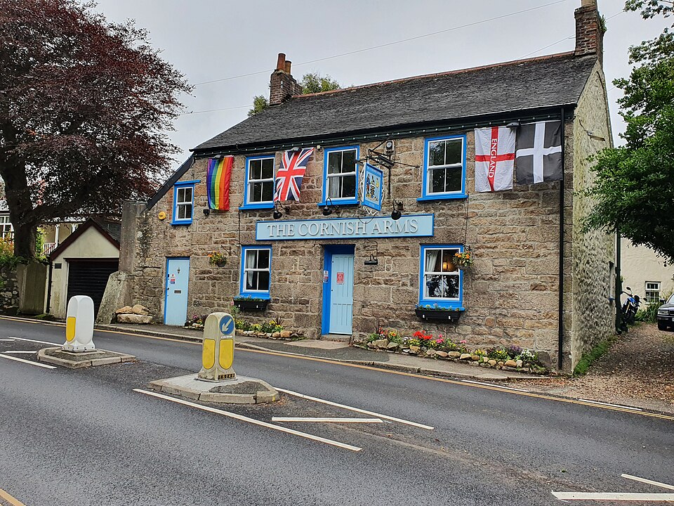
Historical/community camping report; current permission is unconfirmed. A small-scale coastal stop outside Mousehole, where stone walls and low fields break up the otherwise open Mount's Bay coastline. The old directory records a discreet wild-pitch anchor tucked behind a wall between Penzer Point and Point Spaniard. The ground is best thought of as coastalfield/wall edge. Mousehole has full vi...

Coverage not confirmed
Camping permission unconfirmed

Landowner permission required
Lamorna / Carn Du–Kemyel
Wild Camping
Photo: Trevor Rickard
Creator: Trevor Rickard Source: Wikimedia Commons Trevor Rickard · CC BY-SA 2.0 · Wikimedia Commons Source CC BY-SA 2.0 Licence

Lamorna / Carn Du–Kemyel

Lamorna, West Cornwall

Historical/community camping report; current permission is unconfirmed. A steep wooded-to-granite transition around Lamorna Cove, with small headlands and a wilder coastal feel beyond the harbour. The directory says there were several wild-pitch opportunities between Carn Du and Kemyel, exposed to weather, with water/toilets in Lamorna. The ground is best thought of as coastal grass, granite an...

Coverage not confirmed
Camping permission unconfirmed

Landowner permission required Beach
Carn Boel
Wild Camping
Photo: Jim Champion
Creator: Jim Champion Source: Wikimedia Commons Jim Champion · CC BY-SA 2.0 · Wikimedia Commons Source CC BY-SA 2.0 Licence

Carn Boel

Land's End Coast

Historical/community camping report; current permission is unconfirmed. Low, windswept headland south of Land's End with uninterrupted views toward the Longships and open Atlantic. The historic footpath directory calls Carn Boel an exposed but beautiful wild pitch and records no services. The ground is best thought of as exposed low cliff-top heath. No services at the anchor; carry water and al...

Coverage not confirmed

Camping permission unconfirmed

Landowner permission required
Porthtowan Chimney Clifftop
Wild Camping
Photo: Philip Halling
Creator: Philip Halling Source: Wikimedia Commons Philip Halling · CC BY-SA 2.0 · Wikimedia Commons Source CC BY-SA 2.0 Licence

Porthtowan Chimney Clifftop

Porthtowan

Historical/community camping report; current permission is unconfirmed. Mining remains and steep Atlantic cliffs frame this classic north-coast surf village. The old directory records a pitch near the prominent chimney above Porthtowan at SW682474. The ground is best thought of as cliff-top mining landscape. Village services are below; the clifftop anchor is unserviced.

Coverage not confirmed

Camping permission unconfirmed

Landowner permission required Beach
Cligga Head
Wild Camping
Photo: Sue Burrows
Creator: Sue Burrows Source: Wikimedia Commons Sue Burrows · CC BY-SA 2.0 · Wikimedia Commons Source CC BY-SA 2.0 Licence

Cligga Head

Perranporth / St Agnes Coast

Historical/community camping report; current permission is unconfirmed. An industrial-looking but striking headland with old quarry workings, open grass and a much quieter feel than Perranporth below. The historic backpacker directory reports level ground near the quarry at Cligga Head and advises carrying water. The ground is best thought of as old quarry and open cliff-top. No reliable water ...

Coverage not confirmed

Camping permission unconfirmed

Landowner permission required
Droskyn Point
Wild Camping
Photo: Joe Pritchard
Creator: Joe Pritchard Source: Wikimedia Commons Joe Pritchard · CC BY-SA 2.0 · Wikimedia Commons Source CC BY-SA 2.0 Licence

Droskyn Point

Perranporth

Historical/community camping report; current permission is unconfirmed. High ground above Perranporth beach, where mining remains and open cliff-top grass look north across the long bay. The old long-distance directory lists the old mine area at Droskyn Point as a wild-pitch anchor. The ground is best thought of as cliff-top grass and mining ground. Perranporth has full town facilities; nothing...

Coverage not confirmed

Camping permission unconfirmed

Landowner permission required Beach
Backways Cove
Wild Camping
Photo: Philip Halling
Creator: Philip Halling Source: Wikimedia Commons Philip Halling · CC BY-SA 2.0 · Wikimedia Commons Source CC BY-SA 2.0 Licence

Backways Cove

Tintagel Coast

Historical/community camping report; current permission is unconfirmed. A tucked-away cove south-west of Tintagel with a rougher, more enclosed feel than the exposed headlands around it. The backpacker directory describes rough ground, some shelter and a stream at Backways Cove. The ground is bestthought of as rough cove-side grass and valley ground. Historic source mentioned a stream; treat na...

Coverage not confirmed

Camping permission unconfirmed

Landowner permission required Beach
Hole Beach / Tintagel Coast
Wild Camping
Photo: Trevor Rickard
Creator: Trevor Rickard Source: Wikimedia Commons Trevor Rickard / Wikimedia Commons / CC BY-SA 2.0 Source CC BY-SA 2.0 Licence

Hole Beach / Tintagel Coast

Tintagel, North Cornwall

Historical/community camping report; current permission is unconfirmed. A steep, dramatic section of the Tintagel coastline where small coves and rough cliff-top ground create a genuinely wild atmosphere. The historic backpacker directory marks a wild-pitch opportunity at SX054871 on the Tintagel coast. The ground is best thought of as rough coastal ground. No reliable facilities at the anchor;...

Coverage not confirmed

Camping permission unconfirmed

Landowner permission required Beach
Kilmar Tor
Wild Camping
Photo: Hansjoerg Lipp
Creator: Hansjoerg Lipp Source: Wikimedia Commons Hansjoerg Lipp · CC BY-SA 2.0 · Wikimedia Commons Source CC BY-SA 2.0 Licence

Kilmar Tor

Eastern Bodmin Moor

Historical/community camping report; current permission is unconfirmed. Kilmar Tor is a long granite ridge above the old mineral railway, quieter than Rough Tor and distinctive for its angled rock stacks. A dedicated 2022 wild-camping video documents an overnight onKilmar Tor itself rather than merely passing through the area. The ground is best thought of as granite ridge and moor. No faciliti...

Coverage not confirmed

Camping permission unconfirmed

Landowner permission required
Brown Willy
Wild Camping
Photo: Original uploader was StephenDawson at en.wikipedia
Creator: Original uploader was StephenDawson at en.wikipedia Source: Wikimedia Commons Original uploader was StephenDawson at en.wikipedia · CC BY-SA 2.0 · Wikimedia Commons Source CC BY-SA 2.0 Licence

Brown Willy

Bodmin Moor

Historical/community camping report; current permission is unconfirmed. Cornwall's highest point has a surprisingly remote feel, with broad moorland views and rough grass around the summit area. A 2025 camper specifically reports spending the night on Brown Willy after starting at Rough Tor, giving direct modern overnight evidence. The ground is best thought of as high open moorland. No facilit...

Coverage not confirmed

Camping permission unconfirmed

Landowner permission required
The Red Lion
Pub
Photo: Tim Green from Bradford
Creator: Tim Green from Bradford Source: Wikimedia Commons Tim Green from Bradford · CC BY 2.0 · Wikimedia Commons Source CC BY 2.0 Licence

The Red Lion

Falmouth

A longstanding Mawnan Smith pub with a circular bar, log fire, real ale and fresh meals.

Coverage not confirmed
The Halfway House
Pub
Photo: Mr Ignavy
Creator: Mr Ignavy Source: Wikimedia Commons Mr Ignavy · CC BY-SA 2.0 · Wikimedia Commons Source CC BY-SA 2.0 Licence

The Halfway House

Two Waters Foot

A family-run Glynn Valley free house with a garden, open fire and local ales.

Varies by network
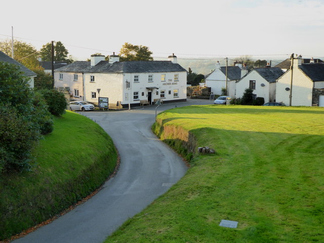
Archer Arms
Pub
Photo: Rod Allday
Creator: Rod Allday Source: Wikimedia Commons Rod Allday / Wikimedia Commons / CC BY-SA 2.0 Source CC BY-SA 2.0 Licence

Archer Arms

Lewannick

A Lewannick village pub with home-cooked meals and puddings.

Coverage not confirmed
The Springer Spaniel
Pub
Photo: roger geach
Creator: roger geach Source: Wikimedia Commons roger geach · CC BY-SA 2.0 · Wikimedia Commons Source CC BY-SA 2.0 Licence

The Springer Spaniel

Treburley

Treburley country pub with a restaurant, snug and separate dog-friendly bar bookings.

Coverage not confirmed
Events

When

Category

Filters

Search filters

Show

Fast picks

Filter & sort